
Lindford, Hampshire, UK

Quick Facts

PHASE BREAKDOWN

AERIAL VIEW
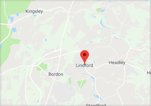
LOCATION
Site Information
The review of East Hampshire Local Plan Review continues and the consultation on the Regulation 18 part 2 was carried out in January this year where representations by us were made.
The Regulation 19 consultation commenced in July this year and is currently underway with our participation. This is scheduled to continue to the end of the year although we anticipate a potential pause whilst East Hampshire waits to see what, if any, implications the anticipated Planning and Infrastructure Bill might have.


Our Planning Department Comments
- The vast majority of the site lies in Flood Zone 2, this is considered suitable for residential development that would not require compensation land but would require any residential units to be built a certain amount above the flood level. Access to the site will be via the neighbouring residential street. The site is however largely enclosed from the wider landscape and physically would appear to be a logical direction for growth.
- The National Planning Policy Framework (the Framework) sets out the presumption in favour of sustainable development. Paragraphs 14 and 49 in particular dictate that where a plan is out of date policies relating to the supply of housing should be considered out of date. In this case, given the recent appeal decision (ref APP/M1710/2226723) which concluded that East Hampshire does not have a deliverable five year land supply in place, the Core Strategy should be considered out of date, with a presumption in favour of sustainable development. The Council has not published an updated land supply report since the appeal decision, but given the defence of their position at the inquiry and the request to submit additional information to the Inspector, it is likely that they would still try to maintain they have a robust land supply position.
- Overall, the site is in an area identified for significant local growth. There can be no argument that in sustainability terms the site is in a good location with access to jobs, services and the wider transport network.
Latest Planning Update
The review of East Hampshire Local Plan Review continues and the consultation on the Regulation 18 Part 2 was carried out in January this year where representations by us were made.
The Regulation 19 consultation commenced in July this year and is currently underway with our participation. This is scheduled to continue to the end of the year although we anticipate a potential pause whilst East Hampshire waits to see what, if any, implications the anticipated Planning and Infrastructure Bill might have.