
Datchet, Royal Borough of windsor and maidenhead Draft Allocation Secured

PHASE BREAKDOWN

AERIAL VIEW
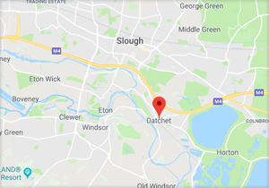
LOCATION
Site Information
Datchet is situated in The Royal Borough of Windsor and Maidenhead in the county of Berkshire. The Royal Borough is renowned for its rich blend of attractive countryside and successful modern business development. There is a wealth of historic buildings, ranging from Windsor Castle and Eton College to the many attractive rural villages.
Datchet is located 20 miles from central London, 5.5 miles from Heathrow Airport and has two main line train stations for London, one of which connects to Waterloo allowing for a new trend of European day-trippers.
As a result of economic prosperity and its proximity to the Thames Valley, the Royal Borough attracts a variety of business enterprises including leading international companies such as GlaxoSmithKline, Hitachi, Johnson & Johnson and Nortel Networks. Forecasts suggest that the Thames Valley economy will grow at a faster rate over the next five years than either the South East or the UK as a whole.


Our Planning Department Comments
- At national level there is currently concern that there is insufficient housing being provided to meet the increasing number of households. Whilst the housing stock has been increasing by 185,000 per year, the number of households is expected to grow by 223,000 per year.
- The land at Datchet is in a highly sustainable location close to all amenities and community services and is well served by all public transport facilities.
- Representations have been made, in relation to the South East Plan, that in order to address the issue of contributing to housing needs the overall strategic housing requirement in the South East plan should be increased to 40,000 dwellings per annum and for Windsor and Maidenhead should be increased from 5,620 to 7,820 dwellings, representing 391 dwellings per annum.
- Although the land currently lies within the greenbelt its specific characteristics are such that it does not have a greenbelt function. Its removal from the greenbelt would be entirely appropriate and assist in meeting the acknowledged need for housing in this part of the South East.
- The physical location of the land, between the settlement boundary of Datchet and the M4 motorway, is such that its development would not lead to coalescence with any other settlement. This is one of the principal objectives of greenbelt designation and thereby would have no adverse impact on the character of the greenbelt or set a precedent for the release of land elsewhere.
- Flood alleviation assessments have concluded that residential development of the site would be acceptable and would not increase the prospect for flooding elsewhere in the immediate locality.
Latest Planning Update
There remains some confusion as to how robust Windsor and Maidenheads Housing Delivery numbers are, but it clearly remains significantly short of the required 5-year target, with it appearing to be as low as 3.7 years. This is going to be further exacerbated by the increased targets that will be implemented once Labour's Planning and Infrastructure Bill is enacted.
Furthermore, once enacted, our site is a very clear example of what they deem should be considered "Grey Belt" sites that should be put forward for development if available.
We await an indication of when a review of the Local Plan will commence but expect this to be done shortly.
We continue to engage with third parties with respect to quarrying of the site for sand and gravel, however all parties are eager to see what impact the impending Planning and Infrastracture Bill might have given its focus on prioritising housing delivery as a matter of urgency.